Cal/Val approach for LSTfusion
LSTfusion products are regularly assessed using a set of well-established validation methods and protocols, such as the CEOS Best Practices Protocols for Global Surface Albedo and Land Surface Temperature Product Validation, ensuring traceability and consistency across validation efforts.
| Ground-based | Reference satellite |
|---|---|
| Copernicus LAW SURFRAD KIT stations JPL stations |
SEVIRI GOES HIMAWARI |
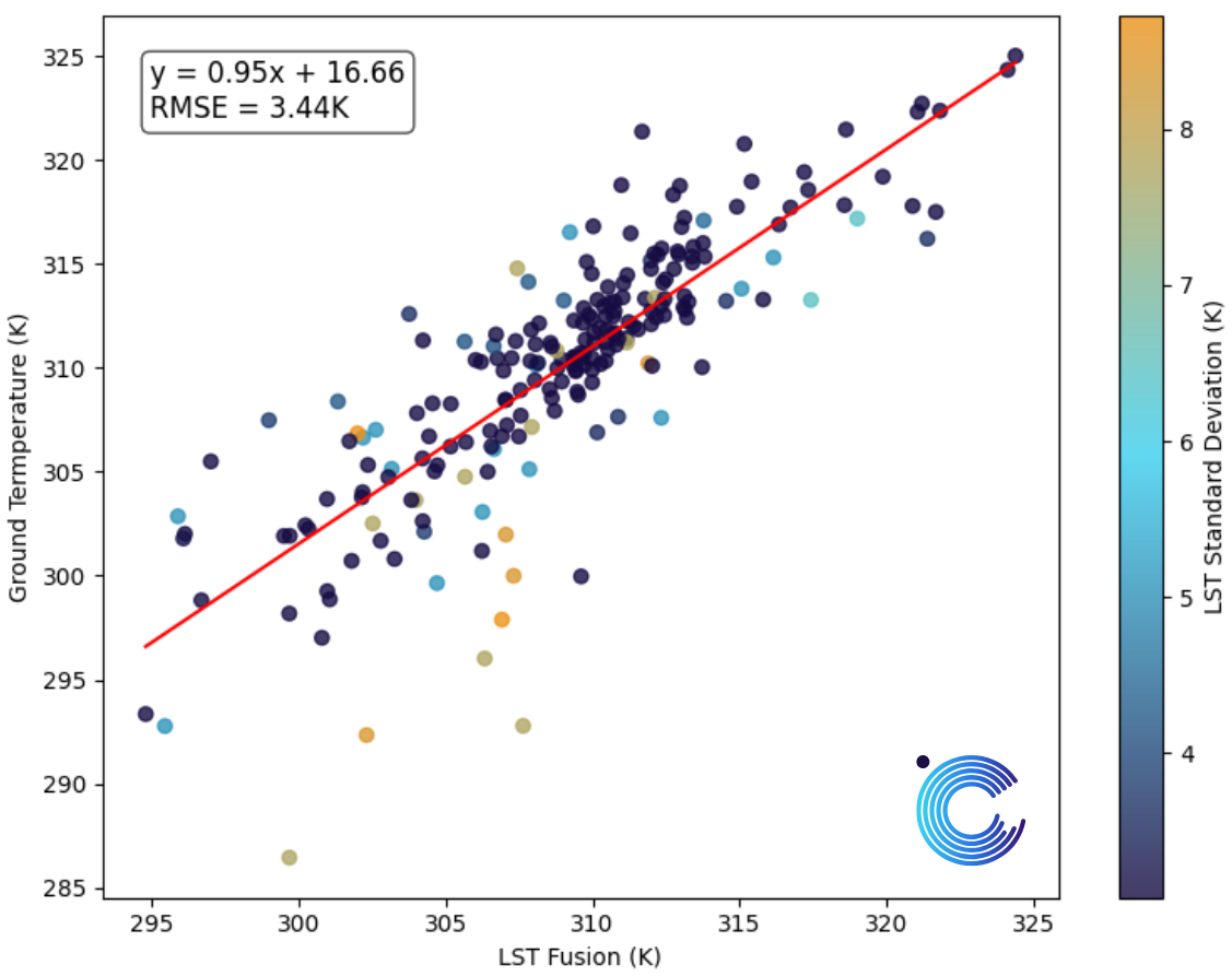
The comparison of the surface temperatures modelled by LSTfusion with reference ground data in the near neighbourhood of key validation sites demonstrates the high accuracy of the LSTfusion. Each data point collected over those reference sites during this early phase of the mission matches nicely the reference measurements. We target an accuracy better than 5K, and under clear-sky conditions, performance is often even better. While certain factors such as persistent cloud cover, snow, or complex topography can affect precision, we have built-in safeguards. Below you can find the comparison of LSTfusion to ground-based measurements in Russel Ranch, an area dominated by agricultural land. A variation from ground-based measurements of about 3.4 degrees is captured, confirming the great assimilation modeling quality of LSTfusion.
Last update: January, 2026
Your gateway to decoding Earth's temperature.
From pixels to planetary resilience.
Explore constellr's data, learn about thermal intelligence, explore our use cases and download actionable demo data sets.