Thermal Insights
Scientifically sound decision-making across industries
Temperature is one of the most critical climate variables, fundamentally governing the water and energy cycle. Across sectors, the impact of rising temperature is profound: in agriculture, it affects crop yields and water availability; in cities, it intensifies urban heat islands and strains public health & energy systems; in infrastructure, it accelerates degradation and failure risk; in defense and intelligence, it alters environmental baselines and operational readiness.


The scale of the challenge is immense. According to IPCC estimates, the global cost of adapting to a 2°C warming trajectory could exceed 1.5 trillion E annually by 2030 across sectors. Thermal intelligence — offering precise, real-time temperature insights — is essential to reduce these costs. onstellr’s high-accuracy thermal data equips decision-makers with the tools to detect vulnerabilities early, monitor evolving risks, and implement targeted, timely interventions that protect assets, resources and lives across civil and security domains.
Vegetation Intelligence
Producing more with less
Agriculture already uses 70% of all accessible freshwater, but with the global population expected to reach 10 billion by 2050, food production must increase by 60% to feed the world. Agriculture faces immense pressure to produce more with less. By providing real-time, high-resolution temperature data, we enable precision farming like never before. Our insights empower you to optimize water use, boost yields, and ensure your land works harder for you – sustainably. With constellr's thermal intelligence, you can make every decision count, transforming the way you grow, harvest, and manage resources. constellr’s thermal data provides a holistic picture of soil and plant health, enabling accurate yield predictions, water optimisation and crop profitability.

Crop Stress Monitoring
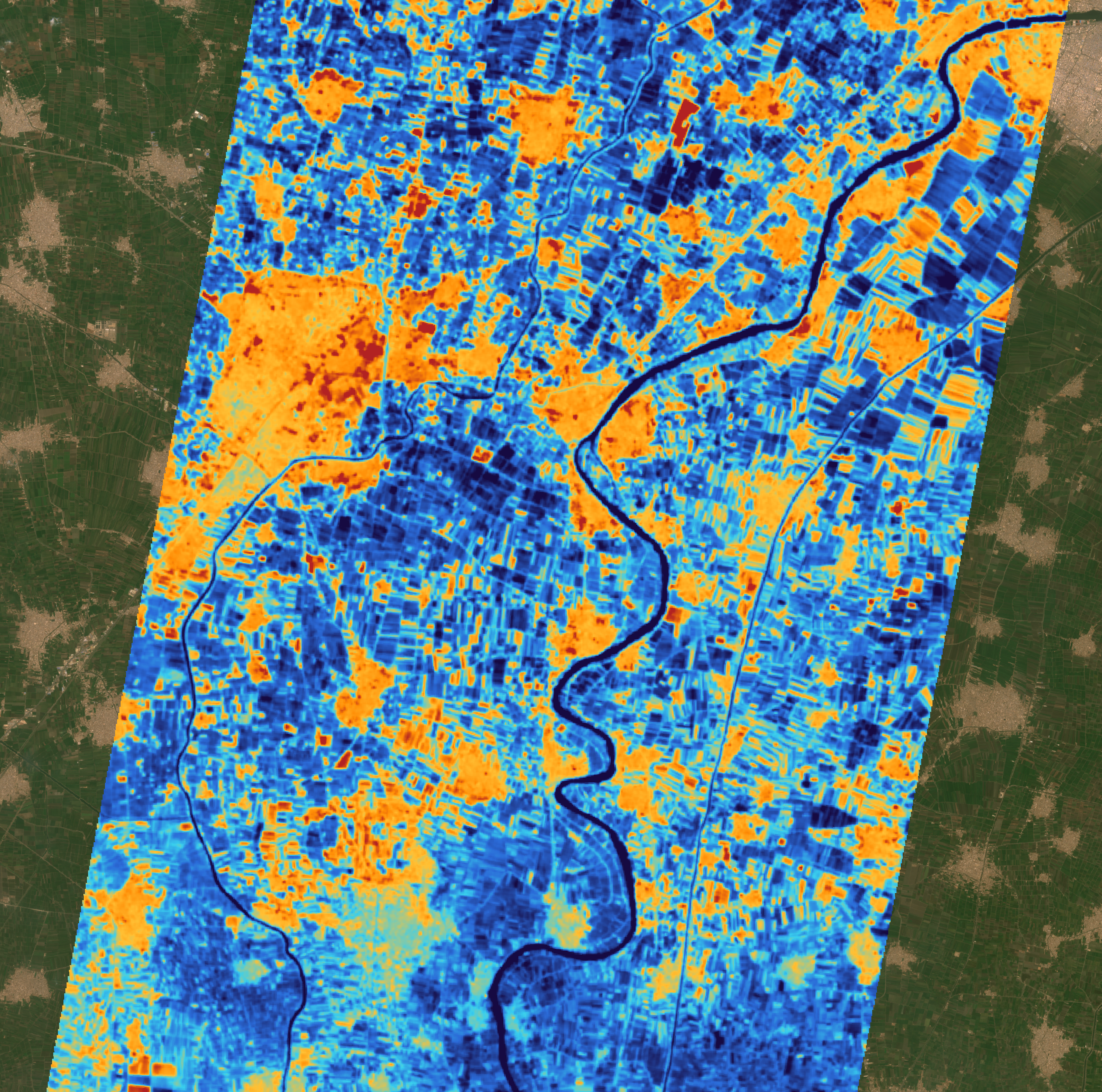
Healthy vegetation is the foundation of successful farming, and subtle changes in temperature can reveal stress before it’s visible. Plant stress that goes unnoticed can lead to reduced yields, wasted water, and the spread of disease. Agribusinesses, retailers, and farmers use thermal data to detect these shifts early, giving them time to take mitigating action and preserve yields.
Soil Temperature Monitoring
Deciding when to plant and how deep to plant into cold soils post winter can be challenging. LST helps agribusinesses, farmers and food chain companies understand the spatial distribution of soil temperature across a field to determine when and how deep to plant, maximizing crop yields from the beginning of the season on.


Biomass and Yield Monitoring
Canopy temperature analysis is detecting changes in plant transpiration hinting at crop stress. Thermal data can provide this information up to two weeks earlier than current tools, enabling food chain companies, financial institutions and traders to spot crop stress with negative implications for yield before the broader market is aware.
Urban Climate Resilience
Beat the Heat
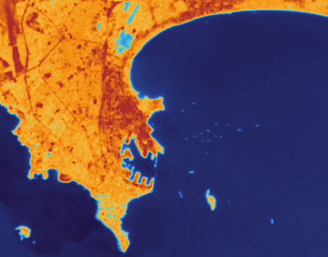
Urban environments are increasingly experiencing elevated temperatures due to the Urban Heat Island (UHI) effect, where dense infrastructure absorbs and retains heat. This phenomenon exacerbates health risks with 61% of the world population living in urban environments today. The costs from heat-related stress alone are expected to reach close to a trillion USD annually by 2050 according to a Rockefeller report. Addressing UHIs through urban planning and green infrastructure is essential to mitigate these health risks and economic burdens, causing municipalities to significantly increase their spend on heat mitigation measures. New York City alone expects to spend 55m USD on heat mitigation by 2030. Additionally, UHIs contribute to increased energy consumption due to higher demand for air conditioning, further straining urban infrastructure and escalating costs. constellr's thermal intelligence helps to identify heat-vulnerable areas for targeted intervention and can support the scalable measurement of the effectiveness of mitigation measures. Thanks to its highly accurate thermal measurements capturing even fine contrasts in temperature variation, constellr enables evidence-based urban planning.

Urban heat islands
In urban environments, constellr’s ability to detect subtle absolute temperature variations helps to identify urban heat islands, areas where human activity and infrastructure result in higher temperatures. Urban heat islands are becoming a growing concern as cities expand and temperatures rise. Our thermal intelligence helps urban planners and governments to pinpoint temperature hotspots within urban areas, identifying zones with excessive heat. This data supports governments and city planners in developing targeted strategies to reduce heat and improve the liveability of their cities.
Heat mitigation measures
Urban vegetation and other heat mitigation measures play a crucial role in reducing heat island effects, improving air quality, and enhancing biodiversity. From trees and parks to green roofs, constellr's thermal intelligence helps urban planners, architects and project developers to track the temperature-reducing effect of mitigation measures on street level, while also enabling monitoring of vegetation health, water usage, and stress levels, enabling better management of urban greenery.

Infrastructure Intelligence
Minimize Risks
Critical infrastructure—including transport networks, energy systems, and industrial sites—faces increased risks from thermal stress, material degradation, and extreme weather, leading to higher maintenance costs. Currently, global maintenance expenditures for transport infrastructure alone are substantial; for instance, the International Energy Agency (IEA) estimates that combined operations, maintenance, and infrastructure additions in land transport could cost up to a trillion USD by 2050. constellr's thermal intelligence, powered by high-resolution land surface temperature data, offers a proactive solution by identifying vulnerabilities such as heat-induced material fatigue, pipeline leaks, and overheating equipment. Early detection through thermal monitoring reduces damages, prevents costly failures, and optimizes maintenance by targeting high-risk areas, thereby extending asset lifespans and minimizing unscheduled downtime. Integrating thermal intelligence into infrastructure management enhances resilience, lowers maintenance costs, and enables adaptation to the escalating impacts of climate change.

Transport infrastructure
Temperature extremes can severely affect road conditions, leading to cracks, ice, and increased wear and tear. Our thermal intelligence helps monitor surface temperatures across road networks, enabling timely interventions for maintenance and repair. Instead of road-level sensors, which are expensive to implement and only offer coverage of specific areas, constellr’s thermal intelligence can monitor large regions simultaneously, ideal for tracking temperature trends across entire cities or highway networks. Whether it's detecting freeze-thaw cycles in winter or identifying heat-induced tarmac damage in summer, municipalities and maintenance companies get the insights needed to reduce road deterioration and ensure safer travel, extending the lifespan of the transport infrastructure and reducing costly emergency repairs.
Energy infrastructure
From power grids to coal plants, energy infrastructure is vulnerable to the impact of temperature changes. Land Surface Temperature data provides critical insights for monitoring and maintaining energy infrastructure by enabling the detection of thermal anomalies, assessing environmental impacts, and enhancing operational efficiency. This reduces the risk of outages and harm. For power plants, LST helps monitor cooling performance, detect heat leaks, and optimize energy output, especially under rising ambient temperatures. For pipelines, temperature irregularities can be detected, signaling leaks early and thus improving safety and reliability.


Industrial Sites Economic Monitoring
By continuously monitoring thermal emissions from industrial sites, we can detect operational inefficiencies, malfunctions and productivity patterns. Our thermal intelligence helps site operators identify and monitor temperature-induced vulnerabilities, offering predictive insights that allow you to act before damage occurs. By tracking temperature shifts that affect structural integrity, we provide a comprehensive view of potential risks— from material degradation to malfunctioning systems - that allow to prioritize repairs and optimize maintenance schedules. Additionally, financial institutions use constellr's thermal intelligence for monitoring the activity of industrial sites to derive productivity information.
Defense & Intelligence
Secure national interests
Protecting national interests in an increasingly unstable world requires timely, persistent, and multi-dimensional situational awareness. Defense and intelligence agencies face mounting challenges — from monitoring hostile activity and infrastructure vulnerabilities to tracking illicit operations such as dark vessel movements and cross-border incursions. Existing Earth observation tools, while powerful, leave critical blind spots in low-light or camouflaged conditions. This is where thermal data becomes indispensable. By capturing the surface-emitted heat, thermal intelligence reveals what’s otherwise invisible: human presence, equipment activity, energy use, and environmental change — day or night. The strategic value is immense: thermal sensing enhances surveillance, accelerates threat detection, and supports mission planning at both strategic and tactical levels. As global tensions rise and the demand for sovereign, high-resolution intelligence grows, thermal data is no longer optional — it's foundational.
Maritime Security: Vessel Detection
Monitoring vessel activity in open waters is becoming increasingly challenging, as more vessels operate without AIS transponders, identification systems, or operate at night to evade radar and optical surveillance. These so-called “dark vessels” pose risks ranging from illegal fishing and smuggling to human trafficking and unauthorized military activity. Constellr’s thermal data detects vessel heat signatures day and night, regardless of light conditions or camouflage, and can even pick up small non-metal vessels often missed by radar, for which radar returns ambiguous signals.. Thermal wakes reveal movement direction, enabling agencies to detect, track, and respond more effectively — strengthening border protection, maritime security, and international collaboration.


Situational Awareness: Terrain Analysis
In dynamic security and defense environments, terrain plays a critical role in operational planning and threat assessment. Traditional optical and radar imagery can map elevation and surface features but often miss subtle environmental cues - such as recent activity, movement, or heat-related anomalies - especially under low-light or obscured conditions. This creates blind spots in situational awareness, particularly in conflict zones, border regions, and remote areas. Thermal data fills this gap by revealing heat signatures across terrain, highlighting soil disturbances, like the creation of trench structures, buried supply lines or other concealed structures. constellr’s thermal intelligence enables detection of heat differentials in ground surfaces, allowing operators to identify paths of movement, and terrain changes — even at night or through partial cover. This adds a critical, persistent layer of insight for real-time decision-making in complex operational environments.

Your gateway to decoding Earth's temperature.
From pixels to planetary resilience.
Explore constellr's data, learn about thermal intelligence, explore our use cases and download actionable demo data sets.