What our satellites capture
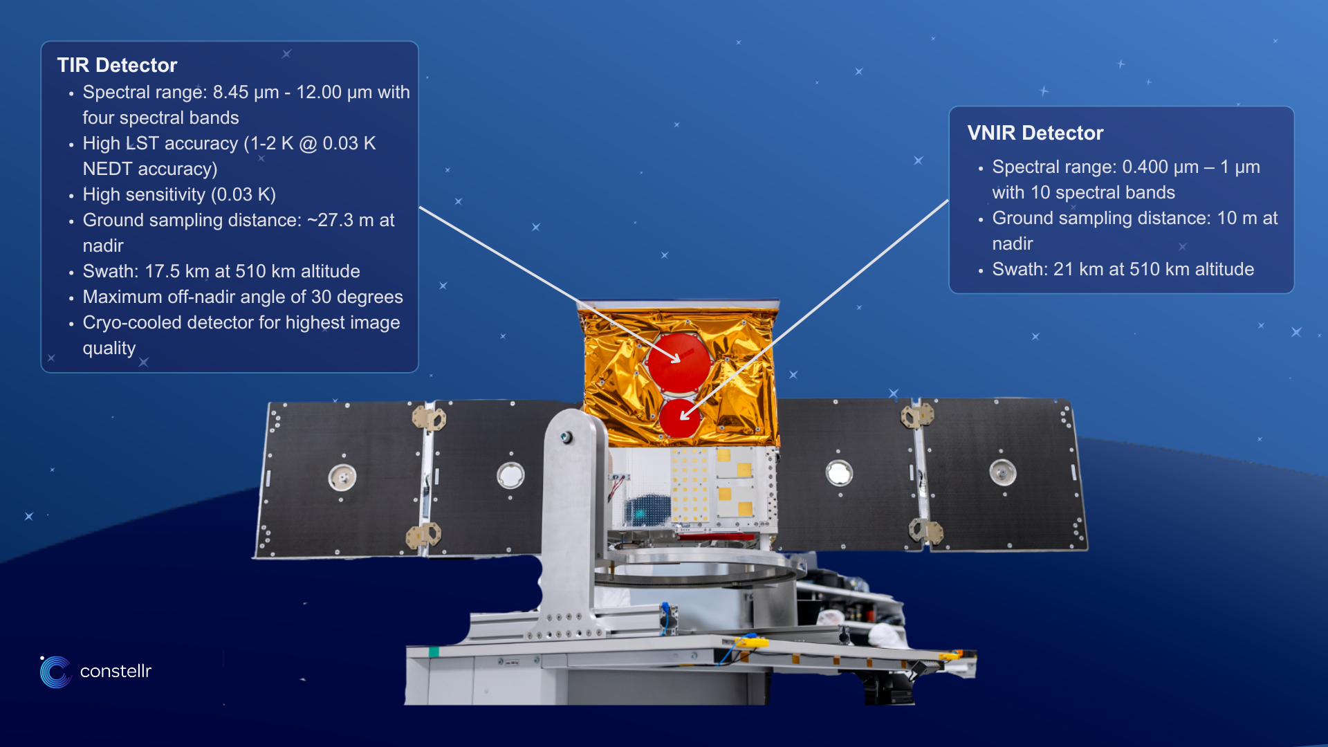
Constellr’s core technology is based on its spaceborne acquisitions by the High-precision Versatile Ecosphere (HiVE) monitoring constellation of micro satellites, the SkyBees. A SkyBee has onboard sensors that acquire high quality thermal and optical imagery. Thus, each SkyBee is equipped with cutting-edge sensors capable of capturing detailed thermal radiation and radiation from the visible and near-infrared (VNIR) part of the spectrum (see Our Technology page for more information).
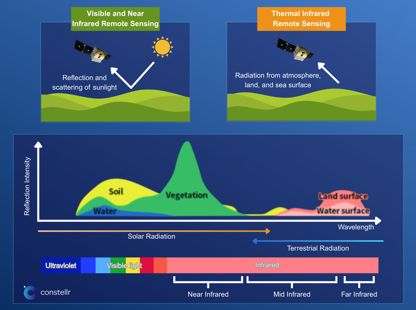
To understand this fully, let's dig a bit deeper into the electromagnetic spectrum, which essentially represents all the different forms “light” can appear in. Light from a physical understanding is a wave, and depending on the wavelength, it carries more or less energy. Short wavelengths are ultraviolet (UV) waves which carry a lot of energy; therefore, they can damage our cells at excessive exposure. They are followed by the “visible light”, i.e. wavelengths that we perceive in different colors. This is followed by the longer infrared wavelengths. The infrared spectrum is very wide and can be divided into the Near Infrared (NIR), Mid Infrared, and Far Infrared. The NIR is an important component of vegetation analysis, as healthy plants reflect a lot of NIR. In comparison, Mid and Far Infrared radiation can give us a sensation of warmth when they reach our skin and are therefore also termed thermal radiation. Furthermore, every object or material with a temperature above absolute zero (0 Kelvin or -273.15°C) will emit some thermal radiation in the form of infrared waves. This can be captured day and night with the appropriate sensors.
Thus, a SkyBee of the HiVE constellation carries one sensor that detects thermal radiation (Far Infrared) emitted from the Earth’s surface and another detects visible and NIR radiation (VNIR) reflected from the same surface, simultaneously. With the captured information, constellr provides Land Surface Temperature (LST), a crucial parameter for climate studies, agriculture, urban planning, and environmental monitoring.
See the figure below and Our Technology page for more detail.
Your gateway to decoding Earth's temperature.
From pixels to planetary resilience.
Explore constellr's data, learn about thermal intelligence, explore our use cases and download actionable demo data sets.